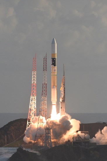
Japan’s H-IIA rocket blasted off from Tanegashima Island Tuesday morning with the final building block in the country’s regional navigation system, designed to improve GPS navigation services in the street canyons of the island nation’s largest cities and deliver enhanced navigation accuracy to aid air traffic control.
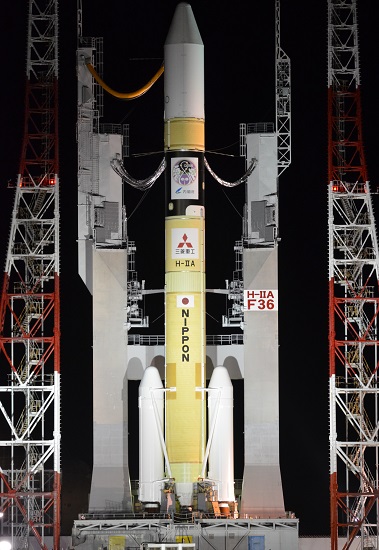
The 53-meter tall H-IIA raced off into the morning skies at 7:01:37 a.m. local time, 22:01 UTC on Monday, heading out over the Pacific Ocean to deploy the fourth satellite in the Quasi-Zenith Satellite System, set to reach its fully operational capabilities by the middle of 2018 for 24/7 navigation augmentation over the Japanese Islands, also providing an additional navigation beacon to the broader Asia-Pacific Region.
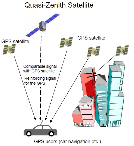
QZSS takes a unique spot in the world’s navigation satellite systems as an augmentation architecture for a foreign constellation. Augmentation services are provided in a twofold manner: a) by sending GPS-compatible navigation signals in the L1, L2 and L5 bands to increase GPS availability and b) by relaying L1S and L5S augmentation signals generated on the ground to allow equipped receivers to factor signal corrections into their position calculations to yield a more precise result.
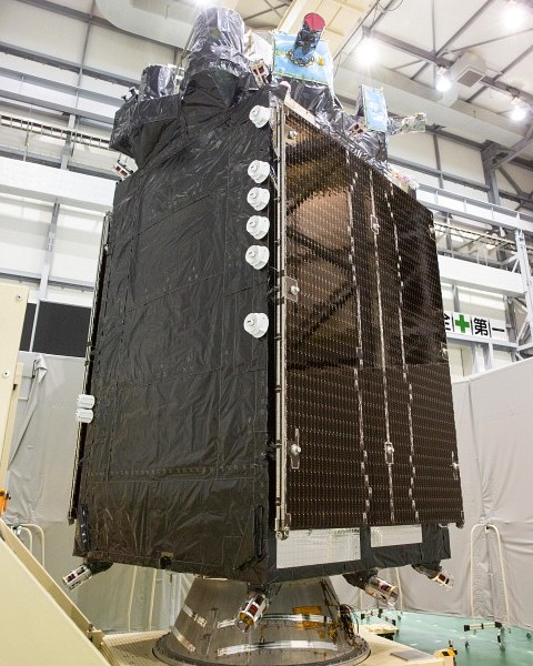
Based on the flight-proven DS-2000 satellite platform, QZS-4 stands 6.2 meters tall and has a launch mass of 4,000 Kilograms, including 370kg for the navigation payload. At the heart of the navigation package sits a pair of redundant Rubidium Atomic Clocks that provide the ultra-stable timing needed for the generation of the navigation signal that is transmitted via an L-Band antenna.
While the navigation signals are generated on board the satellite using the precise clocks as reference, augmentation messages are assembled on the ground by monitoring GPS signal variability through an array of ground stations across Japan and surrounding regions which detect GPS clock errors and other factors like signal delay caused by changes in Earth’s ionosphere. Correction data for these varying factors is uplinked to the QZS satellite which immediately re-transmits it to any enabled receiver in its footprint to then apply the corrections to its navigation solution to yield a more accurate location, on average with one-meter accuracy.
Future Plan:
An expansion of QZSS to seven satellites is planned in the 2020s to add three craft to the elliptical orbit constellation segment so that two satellites dwell at high angles over Japan at any given time.
Launch Video:
[ame="https://www.youtube.com/watch?v=6rL0Y_Mg-Yk"]H-IIA F36 launches QZS-4 (Michibiki 4/æº–å¤©é ‚è¡›æ˜Ÿ ã�¿ã�¡ã�³ã��4å�·æ©Ÿ) - YouTube[/ame]
Congrats! :thumbup:
Source: Spaceflight101.com