\\ Orbiter global level 11 cloud texture (Florida level 12 preview) V1.0 //
This version has very high quality imagery (max. resolution: 320 m/pixel, 160 m/pixel in the level 12 tiles) in various locations (see below) but still has imperfections and a few small bugs that should be fixed with future updates. If you find anything that should be corrected please message me in the forum because at this scale it's hard to find any imperfections if you don't know where to look.
All images courtesy of NASA, image sources: Blue Marble Next Generation Clouds (Base image), Terra & Aqua MODIS, Suomi NPP, NOAA-20 & NOAA-21 VIIRS.
If you click on "More information" to the right on this page, you'll find a link to a zip-file with 30 Scenarios showcasing all the different weather phenomena contained in the textures.
To install, simply place the cloud.tree-file (approx. 4.2 GiB) into your Orbiter\Textures\Earth\Archive-folder.
To make sure the high resolution levels will be shown, you have to edit the file Config\Earth.cfg and set maxCloudResolution = 11.
If you want to test level 12, just put that number in to do that, but unfortunately it is not really displayed the way intented to, possibly because of limitations of Orbiter cloud texture processing.
But for a start, it's an interesting thing to see the improvement, even though for most cases level 11 is more than enough and doesn't have such major glitches.
")
I recommend to set CloudShadowDepth = 0.2 and CloudAlt = 5e3 in Earth.cfg for the most realistic appearance but of course in real life things are much more complex. To stop the clouds from moving (because most of them are specific to certain locations, see description below) set e.g. CloudRotPeriod = 2e100 (you can use any very large value). Of course you can keep them moving and get Hurricanes in the desert or other things where they don't belong, but on the other hand it can make you think about why many clouds only occur in specific locations.
This is after all also meant as an educational project.
That's also why there's a...
\\ List and description of noteworthy cloud formations in the map // (Will grow with future updates)
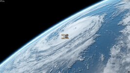
~~ Various thunderstorm anvils around Northern Florida on June 6, 2025
This is the only area with level 12 clouds (160 m/pixel - AI upscaled) - restricted to the rectangular area between 33.75N 90.0W and 22.5N 67.5W, but not all of it has high quality imagery; the highest quality is restricted to the western part, i.e. the immediate vicinity of Florida. It's basically a test / showcase to explore the potential and limitations of higher resolution clouds. Unfortunately for unknow reasons Orbiter doesn't put the level 12 clouds in exactly the right location.
-- Location: North and Northwest of Cape Canaveral
~~ Large Major Hurricane Kirk of Oct. 4, 2024
Hurricane Kirk was a very large Cat 4 Hurricane out on the tropical North Atlantic that never reached land
-- Location: Southeast of Florida
~~ Tropical Storm Victor of Sept. 30, 2021
This tropical storm off the coast of northwestern Africa never reached hurricane strength and never made landfall but still had an impressive size and even almost an eye.
-- Location: Southwest of Cabo Verde Islands
~~ Pacific Major Hurricane Norbert of Oct. 8, 2008
Hurricane Norbert was a Cat 4 Hurricane and went ashore as the strongest hurricane on record in the Baja California Sur region. Unfortunately it did cause damage and loss of life.
-- Location: Southwest of Baja California
~~ Small Tropical Cyclone Marco of Oct. 6, 2008
Marco was the smallest tropical cyclone on record to date according to official sources and like many others did not even develop an eye
-- Location: Gulf of Mexico, Bay of Campeche, west of Yucatan peninsula
~~ Small Hurricane Dora of Aug. 5, 2023
Dora was a small but strong Cat 4 storm in the tropical Pacific and never reached land.
-- Location: Tropical Pacific southeast of Hawaii
~~ Kármán vortices and windward stratocumulus clouds at the Canary Islands
Trade winds blowing from the Northeast against the Canary Islands cause horizontal instabilities in the air flow which influence the formation and location of low level cumulus clouds and thus create mesmerizing swirly patterns. Note how the northeastern side of the Islands is clouded while the southwestern sides are cloud free due to wind-topography interaction (Foehn effect). That's why the Canary Islands are green and mild in the Northeast and rather barren and hot in their southwestern parts!
There's also another little feature in the area mentioned separately below.
-- Location: Southwest of the Canary Islands
~~ Karman vortices in a fractal marine stratocumulus deck at the Baja California
-- Location: Isla Guadalupe south of San Diego
~~ Volcanic Eruption at Cumbre Vieja with gravity waves on Oct. 1, 2021
A very small but still violent enough eruption of the Cumbre Vieja caused stunning circular atmospheric gravity waves emanating from the site, visible through the formation of annular clouds around the eruption.
-- Location: La Palma, Canary Islands
~~ Gravity wave island wake in the roaring fourties
The wind driving a marine stratocumulus cloud layer at high speeds over the peaks of a few lonely islands in the roaring fourties of the southern oceans causes ripples or so-called gravity waves in the clouds in the wake of the islands. When the air is forced up the mountain, air temperature drops, water condenses and the clouds thicken. Once the air starts sinking, temperature increases, relative humidity drops and the clouds dissolve, causing the gaps in the clouds. By standing in the way of the wind, the mountain excites an atmospheric oscillation that continues on for many miles downstream.
-- Location: Crozet Islands, south of Madagaskar, Southern Indian Ocean
~~ Shapiro-Keyser Cyclone St.Jude storm (UK/Ireland) / Orkan Christian/Allan (DK/DE) / Höststormen Simone (Sweden) of Oct. 28, 2013
This was one of the strongest windstorms in Central Europe on record, causing widespread damage in Ireland, the UK, BeNeLux, Germany, Denmark and Sweden. The highest wind gust was measured in Denmark at 194.4 kph, in Germany wind gusts as high as 191 kph were measured. For meteorologists this one is especially interesting because it was a so-called Shapiro-Keyser Cyclone, which among other things develops a distinct dry intrusion into its core associated with a so-called sting jet. It is essentially the jet stream 'falling' down to the surface because of the high negative buoyancy of dry air in the jet stream evaporating cloud tops, thus cooling and sinking even more quickly. Because of the sinking motion and low humidity of the dry air, cloud formation in the area is suppressed and a distinct sector without or with very few, low clouds forms. It is because of this dry intrusion that in many places such extreme wind gusts occurred during a period of sunshine, which is rather seldom in such windstorms. Usually the highest wind gusts are associated with intermittent showers (Cumulonimbus clouds that lead to strong vertical mixing and thus high winds reaching the surface). I experienced this storm first hand at the Baltic Coast and the closest weather station to me measured about 170 kph gusts. So if you see the dry intrusion reaching the Western Baltic Sea that's where I was when this satellite image was taken.
At the same time there were beautiful gravity waves around the Alps - this imagery was also taken on Oct. 28, 2013.
-- Location: Central Europe / centered in Northern Germany & Denmark
~~ The planet rattling Hunga Tonga-Hunga Ha'apai Explosive Eruption of Jan. 15, 2022
The largest volcanic eruption of the 21st century so far and the most explosive eruption observed in the modern age happened in one of the most volcanically active but quite remote regions on Earth. Its ash column reached a whopping 57 kilometres in altitude within one hour since the beginning of the eruption. The atmospheric shock wave traveled the whole planet for several days back and forth and could be visualised in satellite data as well as ground pressure observations all over the world. The author was lucky to by accident have watched the eruption in near real time (through satellite data). Despite its staggering magnitude fortunately most people on the Tonga island survived the eruption and subsequent tsunamis unharmed, 'only' a few people on very flat islands lost their lives but the islands of Tonga were still subject to enormous damage and even across the entire Pacific, in South America, a significant tsunami caused damages as a result of the undersea flanks of the volcano collapsing and displacing large amounts of water.
The eruption was even heard several thousand kilometres away, in New Zealand and even in Alaska and Yukon, at a distance of 9700 km, supported by favourable atmospheric conditions.
This cloud map shows the early growing phase (about 30-40 minutes after the beginning of the eruption) of the large ash plume which in that short amount of time had already reached a mind-bending diameter of approx. 200 kilometres and a height of over 40 km. Because all of the geostationary satellites observing it were doing so at a relatively shallow angle, the original imagery has been edited to resemble a vertical view using the help of generative AI while keeping the overall shape, size and also most fine details of the ash plume. The original image was taken by the Japanese Himawari-8 satellite, you can e.g. see it (and many other amazing facts) here: https://www.cloudsandclimate.com/blog/hunga_tonga_eruption/ (no personal affiliation)
-- Location: Tonga, southeast of Fiji and about 3000 km east of Australia (it's big and despite its remote location hard to miss
)\\ Future updates to include: (If you have any suggestions please message me or post in the forum)
Already prepared:
~~ Hurricane Kate of Oct. 3, 2003
Kate was a Cat 3 Atlantic Hurricane of smaller size with a pronounced eye and never reached land
-- Location: North Atlantic east of Bermuda
~~ Southern hemisphere tropical cyclone Jenna of Jan. 06, 2023
Jenna was a very strong Cat 4 tropical cyclone that unfortunately caused significant damage at landfall in northwestern Australia.
-- Location: Northwest of Australia
More ideas:
- Cloud streets / Lake effect clouds at the Great Lakes, Baltic Sea, Japanese Sea etc.
- Large thunderstorms / MCSs
- Numerous ITCZ storms
- Marine stratocumulus cloud decks with fractal structure
- The same with a vortex structure
- The same with actiniform clouds
- A large roll cloud and atmospheric wave clouds
- Mountain waves & lenticular clouds
- Hole punch clouds
- Dust storms
- Smog
- Large wildfire plumes
- More volcanic eruptions like Etna, Iceland, Aleutians, Kamtchatka etc.
- Fog decks
- Nice cirrus formations
- Cloud "shadows" (air - geography interaction voids)
- Your suggestion or request
- Software License
- MIT
- Supported Orbiter Version
- 2024
- 2016