How does a plane simply 'disappear off the radar'?
Over land, air traffic controllers can use two types of radar, primary, which detects objects by bouncing back a radio signal, and secondary , where the plane sends back an automatic response, identifying itself. Air traffic consultant Doug Maclean, of DKM Aviation, says: "Secondary surveillance radar sends out a coded question, the interrogation message will be received and sent back; that requires a degree of co-operation between plane and the ground. In the likes of the 9/11 incident, the aircraft would have received messages but hijackers had switched off the reply."
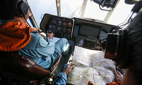
A Vietnamese military helicopter joins the search for flight MH370. Photograph: Athit Perawongmetha/Reuters
But over longer distances where radar coverage is limited – ie usually when planes are flying across oceans – they use another system, Automatic Dependent Surveillance. Here the aircraft transmits its own signal and gives its position via satellites. Maclean says: "Once you go outside primary radar coverage, which would normally be about 100 miles offshore maximum, you are relying on the plane to be transponding."
Malaysia Airlines has confirmed its plane had a system called ACARS, or the Aircraft Communications Addressing and Reporting System, which would also automatically alert engineers at base of any mechanical failure.
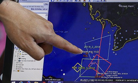
A map of MH370's flight plan is seen on computer screen. Photograph: Athit Perawongmetha/Reuters
So when flight MH370 disappeared from plane tracking websites, it could mean the signals from the plane's transponder were stopped deliberately (by pilots or others), or there was a complete electrical failure, or the plane disintegrated. Where the Malaysian plane was flying, the signals are picked up by sites only once a minute and only at a plane's cruising height above 29,000 feet. So a dramatic loss of altitude could conceivably also see a plane drop off their radar but potentially continue to travel for some distance.
Why are the searches taking place over such vastly different areas?
Searches have been taking place at sea along the original flight path to Vietnam, and on the other side of the Malay Peninsula in the Strait of Mallaca, and are now being widened even further. At cruising altitude the plane would have been travelling at between 500-600mph – allowing for some considerable distance to be travelled if the plane was still intact when it disappeared from the radar. Even with complete engine failure, some aviation experts have estimated the plane could glide for 20 minutes.Malaysian authorities said on Sunday that the plane could have turned just before vanishing. According to tracking site FlightRadar24, the last data it received showed the plane was changing its bearing, but in a way that matched the usual flight path on that route – although the site's experts say the plane could conceivably have changed path after dropping down.(See a fuller explanation
here).


") and as you can see from my map, KUL->MGQ is less than 4000NM.
and as you can see from my map, KUL->MGQ is less than 4000NM.