A joint Japanese-American satellite to observe the Earth's water cycle in unprecedented detail, a Korean optical satellite and 2 nano-satellites for Japanese institutions will be launched today on the H-IIA rocket from Tanegashima Island on the southern tip of Japan.


Launch window:|16:39-16:42 UTC / 12:39-12:42 p.m. EDT / 01:39-01:42 JST
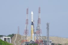
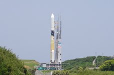
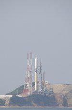
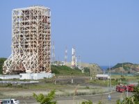
Launch site:|Pad 1, Yoshinobu Launch Complex, Tanegashima Space Center, Japan
{colsp=2}
There is an O-F's calendar event created for this launch, for which you can request a reminder, that will be sent via e-mail on set time before the launch.
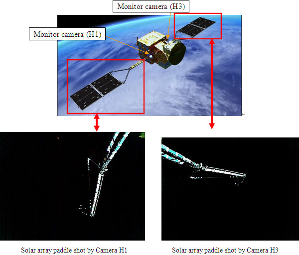
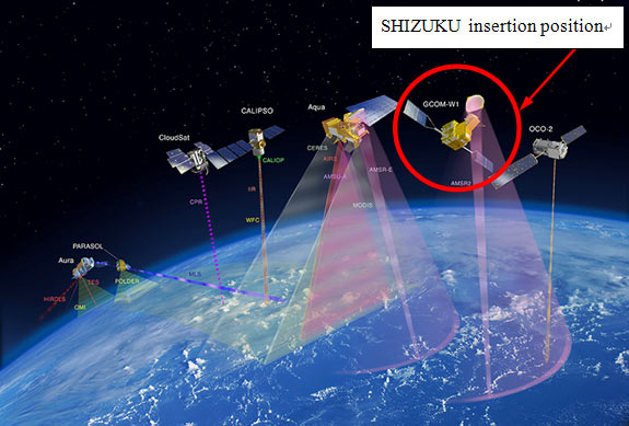
Payload 1:The Global Change Observation Mission - Water (GCOM-W) satellite aims to construct, use, and verify systems that enable continuous global-scale observations (for 10 to 15 years) of effective geophysical parameters for elucidating global climate change and water circulation mechanisms. Water circulation changes will be observed by a microwave radiometer onboard the GCOM-W (Water) satellite (scheduled to be launched in Japan Fiscal Year 2011). The GCOM-W will observe precipitation, vapor amounts, wind velocity above the ocean, sea water temperatures, water levels on land areas and snow depths. Climate change observation will be performed by a multi-wavelength optical radiometer onboard the GCOM-C (Climate) satellite (under consideration) on clouds, aerosol, seawater color (marine organisms), vegetation, snow and ice. These satellites will enable us to perform comprehensive observations of the surface layer of the Earth such as the atmosphere, including clouds, land, oceans and the cryosphere.
The Advanced Microwave Scanning Radiometer 2 (AMSR2) is a sensor to observe radiometers, or microwaves emitted naturally from the ground, sea surface and atmosphere, using 6 different frequency bands ranging from 7 GHz to 89 GHz. The strength of a natural microwave is determined by its characteristics and moisture, including the surface condition and temperature of the material. Although it depends on the frequency, the microwave is very weak. AMSR2 will detect such weak microwaves at an altitude of 700 kilometers and measure the strength of them with a very high accuracy. For example, by measuring the strength of a microwave emitted from the sea surface with the AMSR2, we can understand the water temperature of the sea surface to an accuracy of 0.5 degrees Celsius. The antenna of the AMSR2, which receives microwaves from the ground, arc scans the ground surface at a ratio of one turn every 1.5 seconds and observes an area approximately 1,450 kilometers wide in one scan. Using this scanning method, the AMSR2 can observe over 99 percent of the Earth's area in just 2 days. The diameter of the antenna is about 2 meters, making it the world's largest observation sensor aboard a satellite. The height of the rotating part is about 2.7 meters and the weight is about 250 kilograms. The AMSR2 can keep rotating such a large and heavy antenna at a speed of one turn per 1.5 seconds for 24 hours a day and more than five years without a minute of rest.
The nickname "SHIZUKU (meaning a "drop" or "dew")" has been selected as a result of a naming contest. We asked the public to christen the satellite through the Internet and conventional mail service between July 1 and Aug. 31, 2011. Among the suggestions from a total of 20,998, some 1,392 people proposed "Shizuku."
Some typical reasoning for picking "Shizuku" was that the satellite will observe water circulation, which originated from a "drop" of water that becomes rain, then runs into the ocean, and ultimately evaporates in the air as vapor or becomes ice. Some explained that they would also like the satellite to observe each drop of water carefully. Those descriptions precisely illustrate the GCOM-W1 mission.
{colsp=2}Characteristics

Payload 2:KOMPSat 3 (Korean Multi-purpose Satellite 3) is a lightweight Earth observation satellite developed by the Korea Aerospace Research Institute KARI. It will be similar to the KOMPSat 2 spacecraft and is scheduled to be launched in 2012. The optical component is being developed by Astrium.
It will operate at an altitude of 685 km in a sun-synchronous orbit for 4 years and monitor the Korean peninsula using a payload capable of submeter class resolution. The mission objectives of the KOMPSAT-3 are to provide continuous satellite Earth observation after KOMPSat 1 and KOMPSat 2 and to meet the nation's needs for high-resolution EO (Electro-Optical) images required for GIS (Geographical Information Systems) and other environmental, agricultural and oceanographic monitoring applications.
{colsp=2}Characteristics

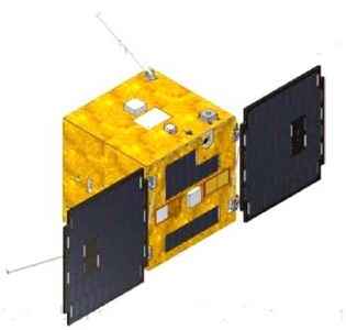
Payload 3:SDS 4 (Small Demonstration Satellite 4) is a small technology experiment satellite developed by JAXA.
As with SDS-1, this small satellite (a cube of 50 kg and 50 cm edge, with a 120 W power available) will test several promising technologies. Unlike the SDS-1 satellite attitude SDS-4 can be controlled on its 3-axis pointing toward the Sun in normal operation phase and to Earth at nadir during his experimental phase. SDS-4 will be launched in 2012 with the GCOM-W1 satellite, and placed on a sun-synchronous orbit at 677 km altitude.
SDS-4 will carry four technology validation missions:
FOX (FHP On-orbit Experiment) will validate the new orbit flat heat pipes for future thermal control systems for satellites.
IST (In-flight experiment of Space Materials using THERME) characterize the degradation of thermal control materials, using the component THERME provided by the French space agency.
QCM (Quartz Crystal Microbalance) will characterize a quartz microbalance developed by the scientific division of JAXA (ISAS), a component that will be useful to develop future sensors that will measure internal contamination.
SPAISE (Space-based Automatic Identification System Experiment), an experiment of receiving signals AIS (Automatic Identification System) from ships, with two dedicated antennas.
{colsp=2}Characteristics
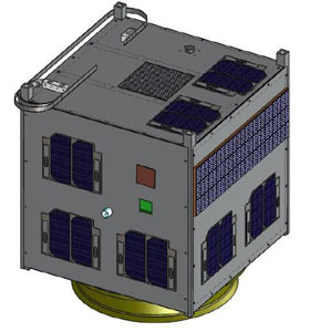
Payload 4:Horyu 2 is a small technological satellite built by Kyusyu Institute of Technology.
Horyu 2 will testing an experimental high-voltage solar array system and observing corresponding spacecraft charging effects on the satellite caused by the high voltage.
Missions:
- Power generation of 300 V in low orbit
- Demonstrating the deterioration of electric discharge control film
- On-orbit demonstration of electron-emitting film (ELF elements) for mitigating electric charging
- On-orbit verification of satellite surface potential meter that was developed based on terrestrial commercial technology
- Debris observation by debris censor
- On-orbit demonstration of the Surrey Camera Payload (SCAMP)
- Taking images by camera for regional contribution and providing educational materials for human resource development using satellite data
Launch Vehicle:
Live coverage of the launch:
Links:
Launch Sequence:
{colsp=2}
Event
|
Time [mm:ss]
|
Altitude [km]
|
Inertial speed [km/s]
*) When the maximum combustion pressure reaches 2%
**) Thrust strut cutoff

Launch site:|Pad 1, Yoshinobu Launch Complex, Tanegashima Space Center, Japan
{colsp=2}
[highlight]L[eventtimer]2012-5-17 16:39;%c%%ddd%/%hh%:%mm%:%ss%[/eventtimer][/highlight]
There is an O-F's calendar event created for this launch, for which you can request a reminder, that will be sent via e-mail on set time before the launch.
Payload 1:The Global Change Observation Mission - Water (GCOM-W) satellite aims to construct, use, and verify systems that enable continuous global-scale observations (for 10 to 15 years) of effective geophysical parameters for elucidating global climate change and water circulation mechanisms. Water circulation changes will be observed by a microwave radiometer onboard the GCOM-W (Water) satellite (scheduled to be launched in Japan Fiscal Year 2011). The GCOM-W will observe precipitation, vapor amounts, wind velocity above the ocean, sea water temperatures, water levels on land areas and snow depths. Climate change observation will be performed by a multi-wavelength optical radiometer onboard the GCOM-C (Climate) satellite (under consideration) on clouds, aerosol, seawater color (marine organisms), vegetation, snow and ice. These satellites will enable us to perform comprehensive observations of the surface layer of the Earth such as the atmosphere, including clouds, land, oceans and the cryosphere.
The Advanced Microwave Scanning Radiometer 2 (AMSR2) is a sensor to observe radiometers, or microwaves emitted naturally from the ground, sea surface and atmosphere, using 6 different frequency bands ranging from 7 GHz to 89 GHz. The strength of a natural microwave is determined by its characteristics and moisture, including the surface condition and temperature of the material. Although it depends on the frequency, the microwave is very weak. AMSR2 will detect such weak microwaves at an altitude of 700 kilometers and measure the strength of them with a very high accuracy. For example, by measuring the strength of a microwave emitted from the sea surface with the AMSR2, we can understand the water temperature of the sea surface to an accuracy of 0.5 degrees Celsius. The antenna of the AMSR2, which receives microwaves from the ground, arc scans the ground surface at a ratio of one turn every 1.5 seconds and observes an area approximately 1,450 kilometers wide in one scan. Using this scanning method, the AMSR2 can observe over 99 percent of the Earth's area in just 2 days. The diameter of the antenna is about 2 meters, making it the world's largest observation sensor aboard a satellite. The height of the rotating part is about 2.7 meters and the weight is about 250 kilograms. The AMSR2 can keep rotating such a large and heavy antenna at a speed of one turn per 1.5 seconds for 24 hours a day and more than five years without a minute of rest.
The nickname "SHIZUKU (meaning a "drop" or "dew")" has been selected as a result of a naming contest. We asked the public to christen the satellite through the Internet and conventional mail service between July 1 and Aug. 31, 2011. Among the suggestions from a total of 20,998, some 1,392 people proposed "Shizuku."
Some typical reasoning for picking "Shizuku" was that the satellite will observe water circulation, which originated from a "drop" of water that becomes rain, then runs into the ocean, and ultimately evaporates in the air as vapor or becomes ice. Some explained that they would also like the satellite to observe each drop of water carefully. Those descriptions precisely illustrate the GCOM-W1 mission.
Mass:
|
- 1900kg
Power:
|
- 4.05 kW
Lifetime:
|
- 5 years
Orbit:
|
- 700 km Sun-synchronous orbit
Inclination:
|
- 98.2 degrees
Payload 2:KOMPSat 3 (Korean Multi-purpose Satellite 3) is a lightweight Earth observation satellite developed by the Korea Aerospace Research Institute KARI. It will be similar to the KOMPSat 2 spacecraft and is scheduled to be launched in 2012. The optical component is being developed by Astrium.
It will operate at an altitude of 685 km in a sun-synchronous orbit for 4 years and monitor the Korean peninsula using a payload capable of submeter class resolution. The mission objectives of the KOMPSAT-3 are to provide continuous satellite Earth observation after KOMPSat 1 and KOMPSat 2 and to meet the nation's needs for high-resolution EO (Electro-Optical) images required for GIS (Geographical Information Systems) and other environmental, agricultural and oceanographic monitoring applications.
Mass:
|
- 800kg
Lifetime:
|
- 4 years
Orbit:
|
- 700 km Sun-synchronous orbit
Inclination:
|
- 98.2 degrees
Payload 3:SDS 4 (Small Demonstration Satellite 4) is a small technology experiment satellite developed by JAXA.
As with SDS-1, this small satellite (a cube of 50 kg and 50 cm edge, with a 120 W power available) will test several promising technologies. Unlike the SDS-1 satellite attitude SDS-4 can be controlled on its 3-axis pointing toward the Sun in normal operation phase and to Earth at nadir during his experimental phase. SDS-4 will be launched in 2012 with the GCOM-W1 satellite, and placed on a sun-synchronous orbit at 677 km altitude.
SDS-4 will carry four technology validation missions:
FOX (FHP On-orbit Experiment) will validate the new orbit flat heat pipes for future thermal control systems for satellites.
IST (In-flight experiment of Space Materials using THERME) characterize the degradation of thermal control materials, using the component THERME provided by the French space agency.
QCM (Quartz Crystal Microbalance) will characterize a quartz microbalance developed by the scientific division of JAXA (ISAS), a component that will be useful to develop future sensors that will measure internal contamination.
SPAISE (Space-based Automatic Identification System Experiment), an experiment of receiving signals AIS (Automatic Identification System) from ships, with two dedicated antennas.
Mass:
|
- 50kg
Power:
|
- 120 W
Orbit:
|
- 677 km Sun-synchronous orbit
Inclination:
|
- 98.2 degrees
Payload 4:Horyu 2 is a small technological satellite built by Kyusyu Institute of Technology.
Horyu 2 will testing an experimental high-voltage solar array system and observing corresponding spacecraft charging effects on the satellite caused by the high voltage.
Missions:
- Power generation of 300 V in low orbit
- Demonstrating the deterioration of electric discharge control film
- On-orbit demonstration of electron-emitting film (ELF elements) for mitigating electric charging
- On-orbit verification of satellite surface potential meter that was developed based on terrestrial commercial technology
- Debris observation by debris censor
- On-orbit demonstration of the Surrey Camera Payload (SCAMP)
- Taking images by camera for regional contribution and providing educational materials for human resource development using satellite data
Launch Vehicle:
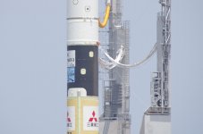
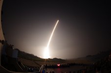
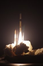
The 21st flight of the H-IIA Launch Vehicle (H-IIA F21) is an "H2A202" type with two solid rocket boosters (SRB-As) attached. The4/4D-LC (4 m in diameter) type fairing is applied.


The launch vehicle is slated for injecting its main payloads "SHIZUKU" and "KOMPSAT-3" in their scheduled orbit. Also it will carry two more small co-payloads to orbit using extra launch capability. After inserting its payloads into their respective orbits, the H-IIA F21 will further perform second stage flight experiments for acquiring technological data of its propellant system in order to upgrade our mainstay rocket as part of our efforts to continuously improving the H-IIA.
Also in this flight experiment, we will test the effectiveness of vapor reduction by coating the second stage liquid hydrogen tank outer surface with white paint, and acquire technological data on the second stage engine precooling status.
Live coverage of the launch:
- JAXA webcast.
Live Broadcast of the launch is scheduled to start on May 17/18 at 12:10 p.m. EDT / 16:10 UTC / 1:10 a.m. JST - i.e. it [eventtimer]2012-5-17 16:10?will start in|started;%c% %h%:%mm%[/eventtimer] hours[eventtimer]2012-5-17 16:10?.| ago.;%c%[/eventtimer] - Countdown Report - Final countdown status of H-IIA Flight F21 will be reported there.
Links:
- GCOM-W1 Special Site.
- Overview of ‘SHIZUKU’.
- Overview of other payloads.
- Shizuku Overview Brochure (PDF).
Launch Sequence:
1.
|Liftoff|
0:00
|
0
|
0.4
2.
|Solid rocket booster burnout*|
1:55
|
51
|
1.5
3.
|Solid rocket booster jettison**|
2:05
|
59
|
1.5
4.
|Payload fairing jettison|
4:10
|
148
|
1.9
5.
|1st stage engine (main engine) cutoff (MECO)|
6:36
|
301
|
3.6
6.
|1st and 2nd stages separation|
6:44
|
313
|
3.6
7.
|2nd stage ignition (SEIG)|
6:50
|
322
|
3.5
8.
|2nd stage engine cutoff (SECO)|
15:26
|
676
|
7.5
9.
|KOMPSAT-3 separation|
16:16
|
676
|
7.5
10.
|Lower fairing adapter separation|
19:21
|
679
|
7.5
11.
|Lower fairing cylinder separation|
19:26
|
679
|
7.5
12.
|Shizuku separation|
23:11
|
683
|
7.5
13.
|SDS-4 separation|
33:20
|
696
|
7.5
14.
|Horyu-2 separation|
50:00
|
692
|
7.5
*) When the maximum combustion pressure reaches 2%
**) Thrust strut cutoff
The current view on Tanegashima Space Center (webcam). *

* This picture is automatically updated at intervals.
You need to reload the page to see the latest image.
* This picture is automatically updated at intervals.
You need to reload the page to see the latest image.