4throck
Enthusiast !
- Joined
- Jun 19, 2008
- Messages
- 3,502
- Reaction score
- 1,012
- Points
- 153
- Location
- Lisbon
- Website
- orbiterspaceport.blogspot.com
I've been trying to get real topography in Orbiter by using Orulex and level 8 heightmaps.
By manipulating the configuration, namely the planetary function, I'm able to minimize the random terrain to the point were it is non intrusive with regard to the real details but the surface still seems interesting an not too smooth.
Also, by reducing the planetary radius to the minimal altitude point, I'm able to solve the below sphere problem. If I move the bases to the lowest points it becomes perfect!
So some questions for the community:
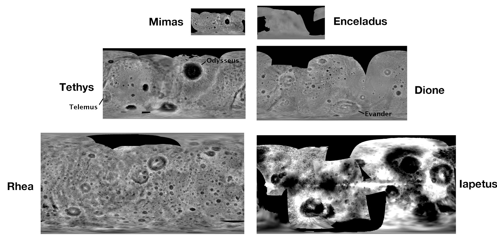
» Is there any interest in accurate and real terrain in Orbiter, (even if low quality) for bodies other than Earth, Mars and Moon?
» Is someone else willing to help with base relocation to lowest points and perhaps create some scenarios?
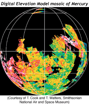
Another thing: I've tried with no success to get a BMP grayscale altimetry image into Orulex, but II always get a flat planet.
The source image is this:

The documentation is not very detailed about the resolution or bit depth required, if the file name needs to be complete along with the .bmp extension, etc. What I really need the config line that load a BMP as global terrain. I can manage the rest on my own.
By manipulating the configuration, namely the planetary function, I'm able to minimize the random terrain to the point were it is non intrusive with regard to the real details but the surface still seems interesting an not too smooth.
Also, by reducing the planetary radius to the minimal altitude point, I'm able to solve the below sphere problem. If I move the bases to the lowest points it becomes perfect!
So some questions for the community:
» Is there any interest in accurate and real terrain in Orbiter, (even if low quality) for bodies other than Earth, Mars and Moon?
» Is someone else willing to help with base relocation to lowest points and perhaps create some scenarios?
Another thing: I've tried with no success to get a BMP grayscale altimetry image into Orulex, but II always get a flat planet.
The source image is this:
The documentation is not very detailed about the resolution or bit depth required, if the file name needs to be complete along with the .bmp extension, etc. What I really need the config line that load a BMP as global terrain. I can manage the rest on my own.
Last edited:
")


